From a robot payload to a product
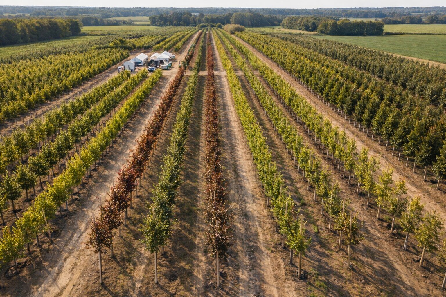
During a project between Exobotic and ILVO, we discussed with tree nursery owners and realised that our robot payloads could solve a much bigger pain than weeds for them: they were losing weeks every season to walking every row, caliper in one hand, notebook in the other, measuring trunk diameters to update their stock and their prices.
With my colleagues at Exobotic, we initiated a spin-off, Arboto, focused on that specific problem: help plant nurseries keep an accurate, up-to-date inventory of their plants, with diameter, species, position on the map, and everything a sales desk needs to quote a tree without walking it first.
My role
- Co-initiator of the spin-off, together with colleagues at Exobotic.
- Collecting customer needs, and translating to specifications and features to build arboto offer in an agile loop.
- Machine-learning pipelines for tree measurement. Two generations were designed.
Generation 1 — cameras-only measurement
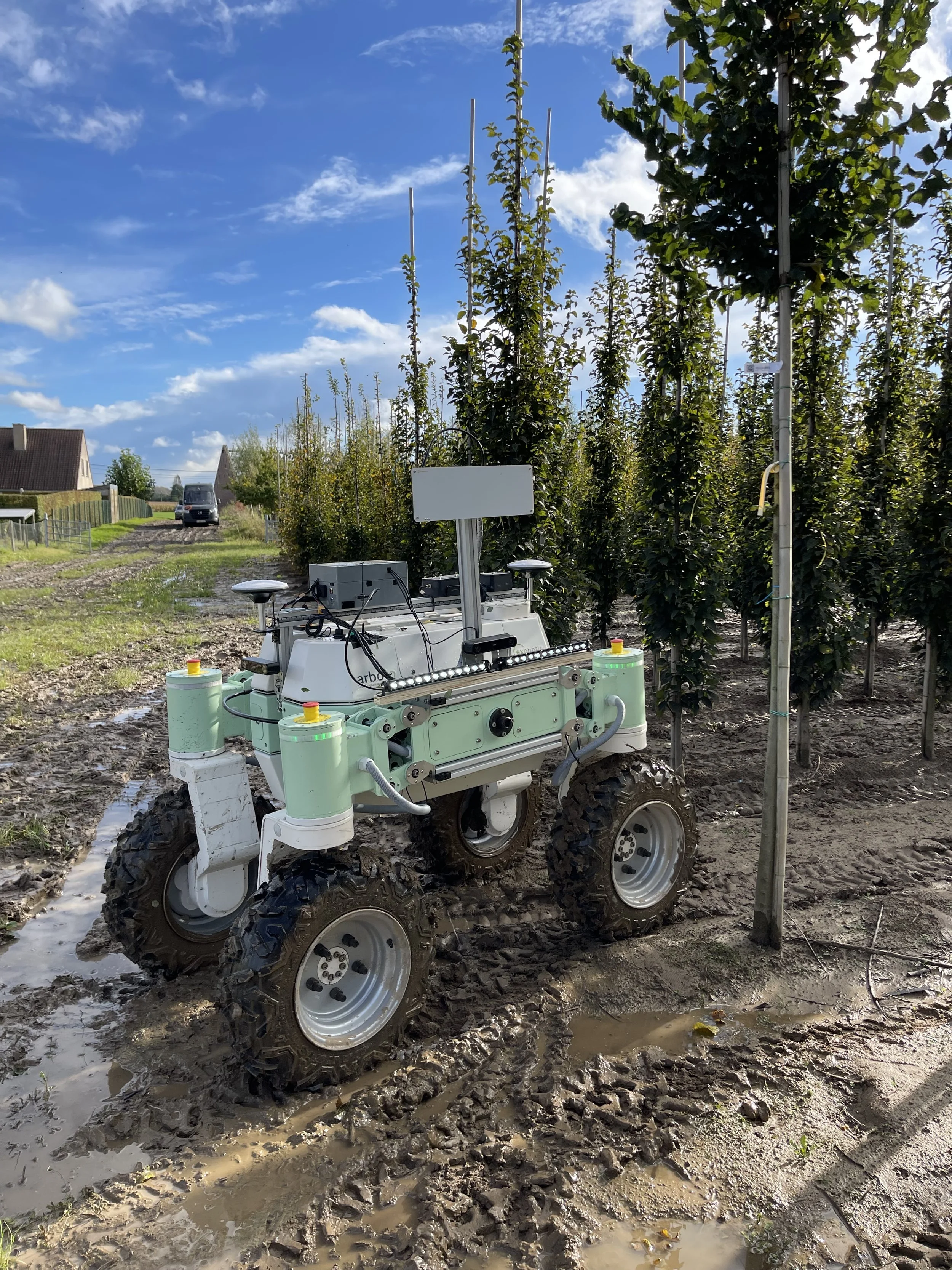
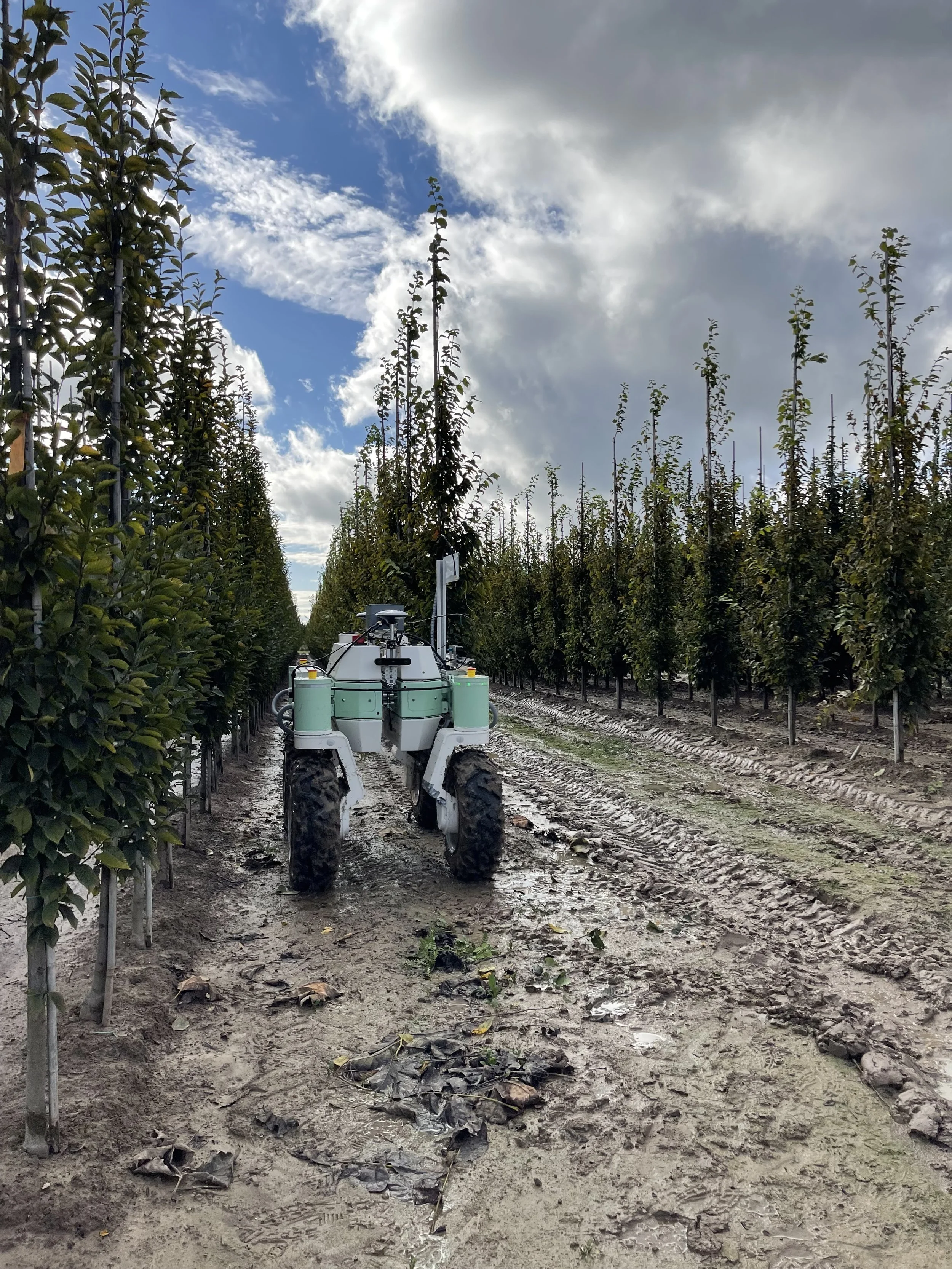
The first pipeline relied on stereo-depth + segmentation, no instrumented tree. The robot drives slowly along the row and for each tree captures several views at known ego-motion.
- 3D depth estimation, producing a dense depth map per view.
- Image Segmentation, to detect the tree on the image, with the capability to differentiate it from the supporting bamboo, generally located just next to the tree trunk.
- Diameter measurement, using statistical aggregation across different views, assigned to a tree position using the RTK-GPS pose at capture time. A single view is wrong by a few millimetres but it can reduce over a dozen views from slightly different angles if averaged smartly.
Source: exobotic.com.
The end result: with only a depth camera and a GNSS sensor, the payload measures trunk diameter at 1 m above ground with ~3 mm accuracy, with no per-tree calibration.
Generation 2 — smart labels
The second generation trades the depth reconstruction for a smart label attached to each tree. A ML model detects the label in the camera stream, measures the current trunk diameter up to 1 mm accuracy, and associates it with the GPS coordinates of the tree.
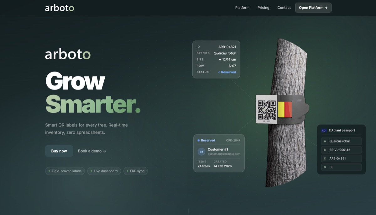
The Arboto product today
Arboto has since turned into a self-standing startup with its own product. In short: “just drive, measure everything.”
- Smart labels. The nursery labels its trees once with Arboto QR tags.
- arbo-Eye. A vehicle-mounted camera device that reads every label automatically as it passes, continuously, with no stopping, covering entire fields in minutes instead of hours.
- Cloud inventory. Scans flow straight into an Arboto dashboard: a live, up-to-date inventory with species, diameters, measurement history, positions on the field map, and a public scan page for visitors.
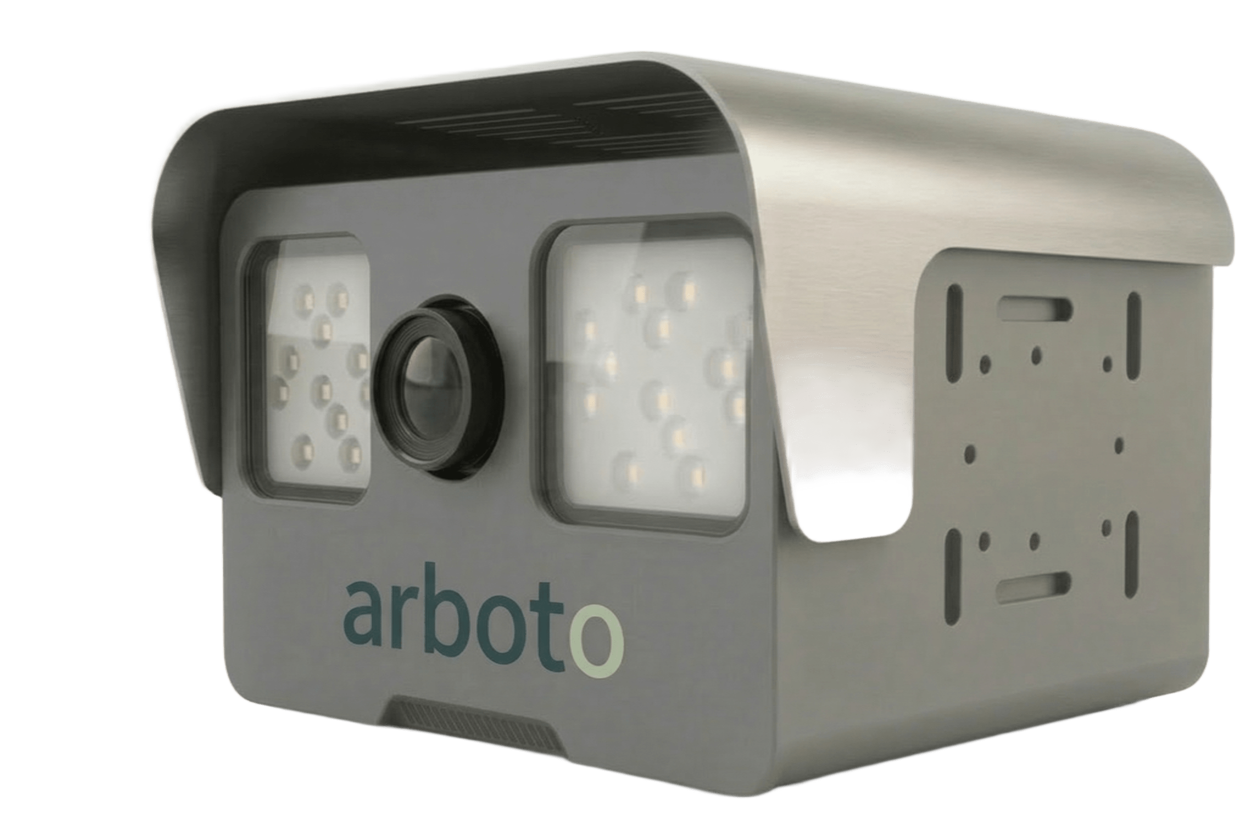
arbo-Eye render and demo video: arboto.eu.
Going further
- Arboto (the spin-off): arboto.eu.
- Scientific partner on the original project: ILVO.
- Exobotic Land-A2 platform: exobotic.com/platforms.
- The 4WD/4WS robot this pipeline originally ran on: Land-A2 robot.
Sources
This article only summarises information already publicly available. Pictures and quoted content come from: